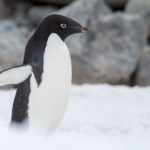
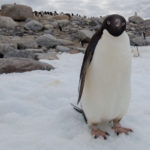
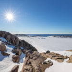
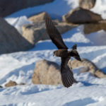
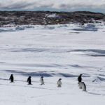
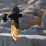
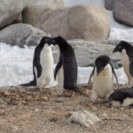
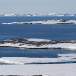
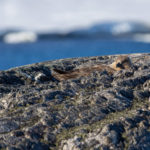
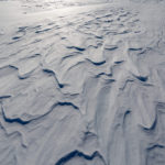
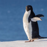
During a sea trip in a IRB (Inflatable Rescue Boat) we passed by some small ice bergs and an island with some penguins.

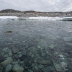


66.2821° S, 110.5285° E
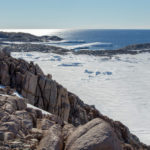
During a sea trip in a IRB (Inflatable Rescue Boat) we passed by some small ice bergs and an island with some penguins.
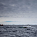
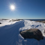
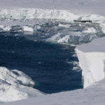
A couple of videos looking North out to sea with ice bergs in the distance
The unloading of cargo from the Aurora Australis, its the once a year re-supply voyage for the station.
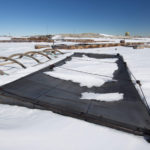
Fuel pumping from the ship to shore, around a million litres of diesel was pumped over two days. The boats monitor the fuel line and move floating ice away from the floating fuel line.
Aurora Australis, arrives at Casey Station for resupply however the weather is deteriorating (a blizzard is forecast) so it leaves for safer waters and will return for resupply when the weather improves.

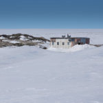
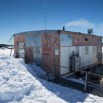
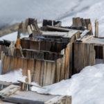
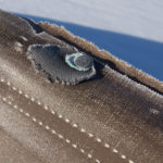
I visited Wilkes station recently and stayed overnight in a hut, below are some pictures and a brief history.
Wilkes station, 66° 15′ 25.6″ S, 110° 31′ 32.2″ E, was established on 29 January 1957 by the United States of America as part of the International Geophysical Year (IGY) program in Antarctica.
Under an agreement with the United States, Australia was permitted to use the station stores and supplies that remained, on condition that nothing was removed and the Australia reported annually to the USA on consumption of the stores and supplies. A hand-over ceremony was held on 7 February 1959. Australia used the station until it occupied the new Casey station in 1969.
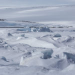
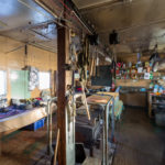
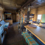
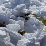
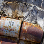
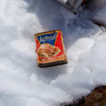
Wilkes station is now almost permanently frozen in ice and is only occasionally revealed during a big thaw every four or five years. Many objects remain embedded in the ice, and visitors are often able to see the remains of the station through the ice, seemingly exactly as it was left.
What remains at Wilkes are a number of barracks buildings known as Clements huts, and the remnants of the semi-cylindrical canvas store buildings known as Jamesway huts
Source text and further information:
http://www.antarctica.gov.au/about-antarctica/history/stations/wilkes

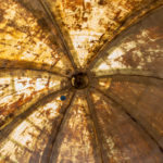

It is finished, a wide angle shot from the entrance.
After survival training a hot shower and some breakfast I shot this small video from my room.
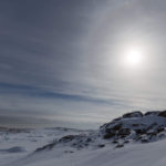
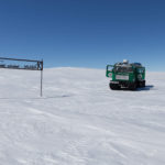
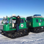
Last week I was in survival training, which entails navigating with a compass and maps a GPS and learning how to survive on your own in the open in Antarctica without shelter (no tent).
Interestingly down here in Antarctica compasses won’t point to magnetic North they are out by around a 100 degrees this makes navigating with a compass and maps more difficult. GPS is also unreliable at times due to blizzards and the low angle; our satellite dish points only 7 degrees above the horizon.
I have included a few short videos; one from inside the Bivy. Let’s say you get caught in a Blizzard (we had a Blizzard the night while I was on the survival which was great as it made the training real) there is no shelter, so you have to Bivy it. The Bivy we have was like big bag similar in shape to what your sleeping bag packs but yellow transmits light and is noisy like a chip packet with a drawstring at one end and it keeps the wind off you.
You get your Bivy off your backpack unroll it (don’t let it blow away or you in big trouble) throw your backpack in, climb into it pull the drawstring get your sleeping bag out and climb into it and shelter from the Blizzard.
Whats its like in a Bivy? Wind over a 100 km an hour so very noisy, minus 17 a bit cold and because the sun does not set it’s like daylight inside the Bivy. Another interesting observation or two is that your breath condenses on the inside of the Bivy then freezes and falls onto you, it was like it had lightly snowed inside the Bivy. I reached for my water bottle (inside the Bivy next to my sleeping bag) to get a drink, but the water had frozen a rooky mistake I should have had it the sleeping bag.
I climbed in at 7:30 PM and out the next day at 6:30 AM didn’t get much sleep, but it was an awesome experience.
Walking from the Field Training Office to the Red Shed